
Mauritius Set to Launch Its Second Satellite

As a small island developing state, Mauritius faces unique challenges, largely driven by its small size, isolation and environmental vulnerability. These factors increase exposure to climate change and extreme weather events, placing pressure on critical areas such as coastal management, food security, and disaster preparedness. Recognising this, the government has increasingly turned to cutting-edge technologies to strengthen resilience and inform decision-making. In particular, space technology has become a strategic focus, offering capabilities in earth observation, maritime monitoring, and environmental management.
Through the Mauritius Research and Innovation Council (MRIC), the country has built local expertise in satellite engineering and data applications and promoted research and partnerships to harness space-based solutions to address national development challenges. Furthermore, in 2021, Mauritius launched its first nanosatellite mission, establishing essential national capacity and marking the country’s initial entry into space. It enabled the country to understand the fundamentals of space operations, to uncover the broad potential of satellite data for national development, and to recognise how such capabilities can strengthen climate resilience, expand Earth observation opportunities, and improve the lives and livelihoods of Mauritians.
In this interview, Dr Vickram Bissonauth, Research Coordinator at the Mauritius Research and Innovation Council (MRIC), and Ziyaad Soreefan, Aerospace Engineer and Technical Lead at MRIC, discuss the highlights of the Mauritius Space Programme in 2025 and the outlook for 2026.
MRIC has engaged with key partners, including Airbus and ISRO, over the past year. What were the most significant milestones and outcomes from these collaborations?
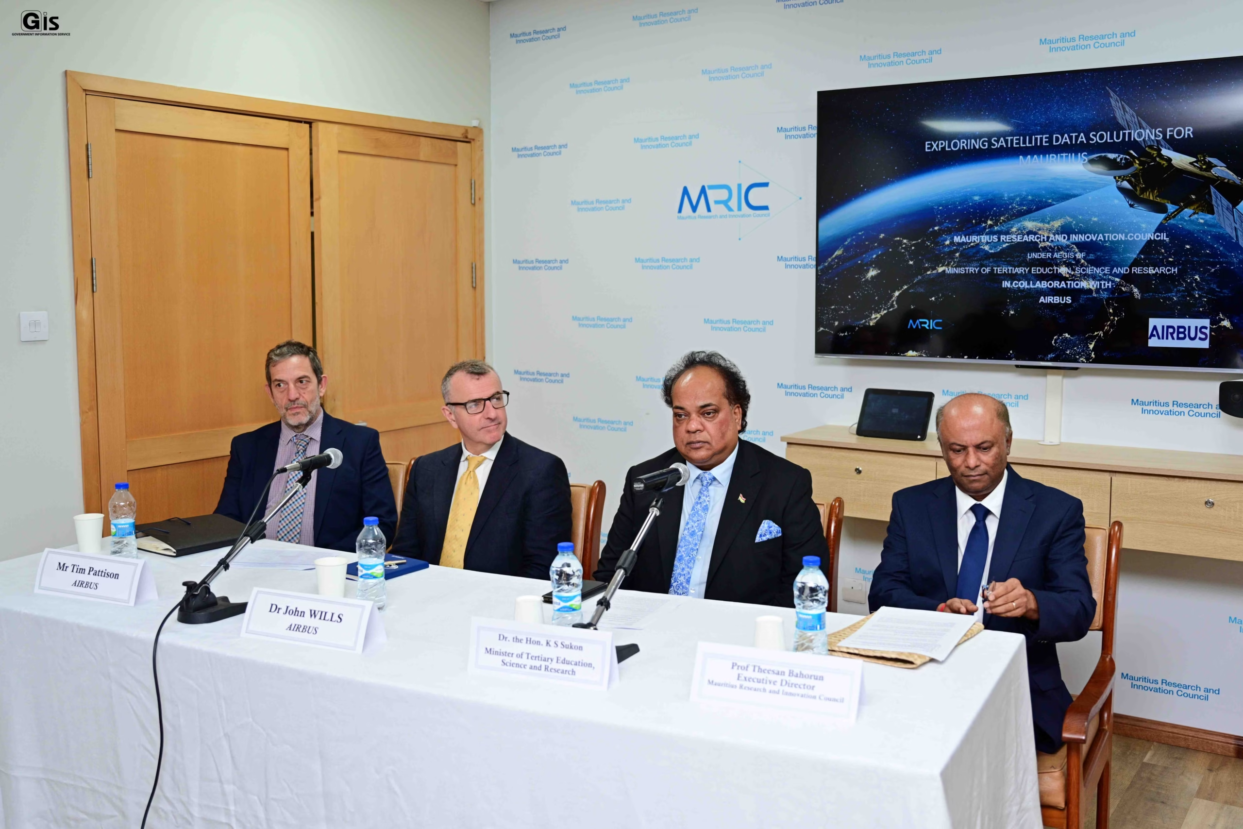
Over the past year, we have convened two major workshops and engaged with various stakeholders to advance our space initiatives. The first workshop, held in July 2025, in partnership with Airbus and hosted by MRIC, brought together approximately 70 participants from government institutions, ministries, and private-sector organisations. Airbus experts presented on satellite data applications and demonstrated how these technologies could address the country’s most pressing challenges.
One case scenario demonstrated the use of high-resolution satellite imagery (50cm) for beach monitoring along Mauritius’s coast. Beyond showcasing applications, we intend to develop a robust infrastructure platform to enable data download and utilisation for stakeholders nationwide. Our goal is to build local expertise and technical capacity, positioning MRIC as the nation’s leading satellite data provider. We are also exploring potential collaboration with the Italian Space Agency, with management currently reviewing the proposal to determine alignment with our strategic priorities.
Beyond Airbus, you’re collaborating with ISRO on a joint India-Mauritius satellite. What’s the current status, and when is launch expected?
We are collaborating with the Indian Space Research Organisation (ISRO) on a joint India-Mauritius satellite project focused on capacity building, one of the key pillars of our space programme. As part of this collaboration, three of our engineers are receiving hands-on training in Bengaluru, India. The satellite has now progressed to the Assembly, Integration and Testing (AIT) phase, with launch anticipated soon.
This will be Mauritius’s second satellite, further strengthening the country’s space programme. We will utilise our existing ground station from the 2021 nano-satellite mission, with upgrades to support the new capabilities. The system now enables faster satellite tracking, with an angular tracking capability of approximately 5-6 degrees per second. Planned upgrades to the X-band infrastructure will further enhance performance, enabling more efficient download of high-resolution payload data. Additionally, this will complement a ground station at ISRO, which will support downloading the satellite’s data. This project will also serve as a pilot for Mauritius to develop its capabilities.
The ground station has been operationally supporting ISRO missions since 2022, providing critical tracking and telemetry services. Planned upgrades will significantly enhance these capabilities, enabling more comprehensive support for ISRO’s future missions and expanding our ground-station-as-a-service offering for commercial purposes. Technically, the satellite falls into the microsatellite category, weighing 15kg, with deployable solar panels that extend up to 1 metre. It will be equipped with a multispectral imager with 11-15 km resolution and will operate in a descending sun-synchronous orbit. ISRO will provide the satellite launch vehicle. This satellite will primarily support capacity building and enhance national awareness of the potential of space and satellite technologies to drive scientific advancement, strengthen research and development, and foster insights into how space can emerge as a new socioeconomic growth sector for Mauritius.
We look forward to sharing more detailed progress on these initiatives at the upcoming NewSpace Africa Conference!
What are the key priorities and objectives driving the Mauritius Space Programme?
Our primary objectives for satellite data applications align directly with government priorities and address critical national needs: monitoring flash floods and landslides, managing beaches and coastal areas, and enhancing maritime surveillance. In each of these areas, satellite data provides essential insights for informed decision-making.
Space technology is particularly valuable for tracking changes over time through time-series data, enabling us to monitor coastal erosion patterns and detect illegal fishing activities. This temporal analysis capability addresses a crucial gap in our current monitoring infrastructure. To facilitate access to satellite data, we intend to develop a repository platform that will allow government entities and stakeholders to source imagery directly from us, serving as a valuable resource to enhance decision-making across multiple authorities.
We are working toward developing this capability with the interest and preliminary engagement of partners such as Airbus and local telecommunications providers, who may contribute expertise in digital infrastructure and satellite datasets. As the initiative progresses, the platform is expected to provide tailored, sector-specific data to support applications such as land-use planning and maritime management. We also aim to explore the use of artificial intelligence to help transform satellite data into practical, decision-ready insights for national stakeholders.
How is Mauritius’s NewSpace ecosystem developing, and what progress has been made?
Mauritius’s NewSpace ecosystem is still at its nascent stage. At present, local activity is limited, and no major implementation efforts have begun. While some foreign organisations have approached Mauritius—mainly to explore potential collaboration—these exchanges have so far remained at the level of preliminary discussions, with no concrete projects initiated. At the national level, the government, through the MRIC, has initiated early dialogueand groundwork to better understand the opportunities and requirements for developing a local space ecosystem. This includes initial engagement with universities on the possible introduction of space and satellite-related academic programmes, as well as exploratory thinking around future infrastructure needs.
Although these efforts are in the early stages, the aim is to build awareness, encourage capacity development, and create conditions that enable local expertise and homegrown initiatives to emerge over the long term. However, the ecosystem remains in the preparatory and consultation phase, with most elements yet to be implemented.
Furthermore, Mauritius’s geostrategic location has attracted significant NewSpace activity, particularly in the telecommunications sector. Companies such as Eutelsat’s OneWeb have established operations here to leverage ground-station capabilities for tracking and telemetry services. However, inadequate funding remains a persistent challenge in promoting the growth of local space companies. This funding gap is a significant barrier to entry across Africa, in stark contrast to the well-funded initiatives available outside the continent. Consequently, many promising African space companies have expanded into regions with stronger funding ecosystems.
One recommendation we have for the African Space Agency is to help establish an alliance for Small Island Developing States (SIDS) focused on space technologies. Given the significant number of small island developing countries facing climate change vulnerabilities, such an alliance could explore how space technologies can help mitigate these challenges. It would also create a unified voice for SIDS in global space discussions, including space debris and traffic management.
What Can We Expect from the Mauritius Space Programme in 2026?
Looking ahead to 2026, MRIC has outlined several key priorities to advance Mauritius’s space programme. The organisation plans to finalise one or two research proposals for submission to climate financing funds, reflecting the critical role of space technologies in addressing climate vulnerabilities faced by small island developing states. Engagement with the Italian Space Agency remains a priority, with plans to finalise upcoming meetings and explore potential collaboration opportunities. MRIC also aims to strengthen its technical capacity by recruiting additional space scientists to the programme, addressing the growing demand for local expertise as the country’s space initiatives expand.
On the infrastructure front, MRIC will focus on launching its data platform and repository to provide easier access to satellite data for government entities and stakeholders. MRIC will also analyse the outcomes of research organisations’ use of data to better understand how satellite information is applied and where improvements can be made. Mauritius continues to engage actively on the international stage, participating in the UN Committee on the Peaceful Uses of Outer Space (COPUOS). The country has formally registered its concerns as a Small Island Developing State in official documents, ensuring that the unique challenges and perspectives of SIDS are represented in global space governance discussions.