
Remote Sensing
YouthMappers 10th Anniversary Symposium
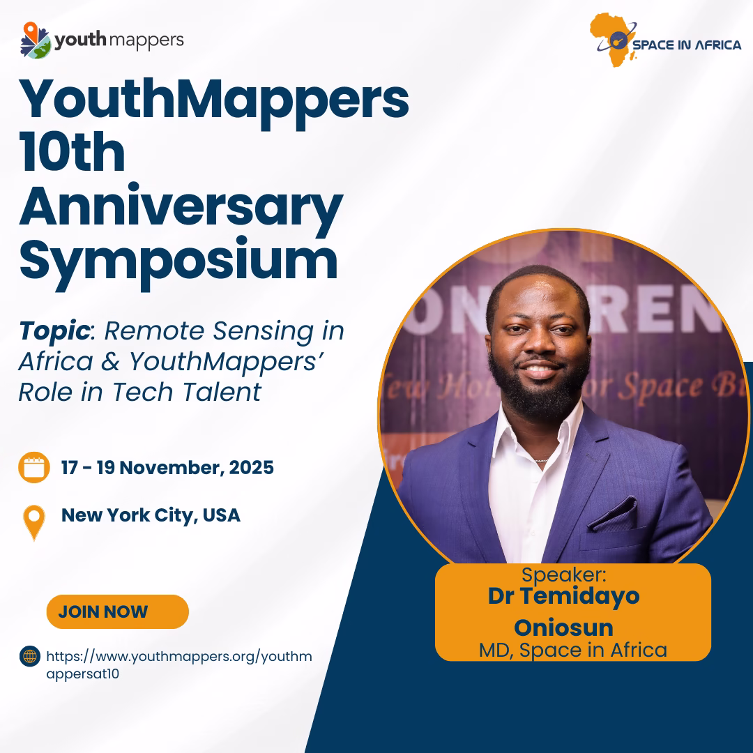
YouthMappers will mark its 10th Anniversary Symposium from November 17–19, 2025, in New York City, convening government representatives, academic leaders, private sector partners, and members of its global network.
The event will celebrate a decade of youth-led open mapping efforts that have contributed to community development across more than 80 countries, advancing progress toward the UN SDGs. The symposium’s programme will feature panel presentations on mapping’s impact in areas such as global health, climate resilience, disaster preparedness, and local capacity building. It will also include sessions on workforce development, innovation, and recognition of sponsors, alumni, and key contributors.
As part of the symposium, Dr Temidayo Oniosun, the Managing Director of Space in Africa and ex-YouthMappers Leadership Fellow, will be delivering a presentation on “Remote Sensing in Africa & YouthMappers’ Role in Tech Talent,” to explore how geospatial technologies are shaping Africa’s innovation ecosystem, and how youth-driven initiatives can support the continent’s talent pipeline.

TUNSA to Advance Partnership with CRTEAN to Boost Collaborative Efforts
A delegation team from the Tunisian Space Association (TUNSA) led by its President, Engineer Ahmed EL Fadhel, was hosted by the Regional Center for Remote Sensing of North African States (CRTEAN) Director General, Dr Al-Hadi Imhamed Gashut at the CRTEAN headquarters. The strategic meeting stemmed from the cooperation agreement signed between CRTEAN and TUNSA in October 2022.
The meeting provided an opportunity to review the various programmes and initiatives executed by both entities in recent times and those in progress. Engineer Ahmed EL Fadhel and his team, including Rihab Ben Moussa and Fadhel Essid from TUNSA's strategic relations division, highlighted various opportunities and avenues aimed at advancing deeper collaboration at the national and regional levels
Furthermore, in the coming days, TUNSA will provide CRTEAN with a comprehensive list of proposed initiatives, underscoring the mutual commitment to advancing scientific cooperation and technological innovation within the region. In addition, the meeting underscores the commitment of both CRTEAN and TUNSA to foster a robust partnership that leverages expertise and resources to address pressing challenges and unlock opportunities in remote sensing.

The Role of Space Technologies in Improving Africa’s Over USD 14.5 Billion Cocoa Market
Cocoa is one of Africa's most important cash crops and is crucial in several African countries' economies. However, Africa’s cocoa industry faces several challenges that hinder its growth and development. One of the most significant market downfalls is the need for more reliable and accurate data about the conditions of cocoa farms, health and growth, among others, making sustainability of the industry difficult.
However, the African climate plays a crucial role in determining the productivity of cocoa across the continent, with a particular emphasis on West Africa. This region alone contributes to over 60% of global cocoa production. Cote d’Ivoire is the biggest cocoa producer, contributing around 38% of the world’s cocoa production.
For Ghana, the biggest cocoa producer after Cote d’Ivoire, the cash crop plays a vital role in its economy and is the most significant contributor to its foreign exchange. Furthermore, planting cocoa is essential in securing land rights in the country. As part of the customary land tenure systems in rural areas, cocoa farmers can demonstrate their traditional land rights and strengthen their authority over land ownership because of its long-term nature. Moreover, owning a cocoa farm secures access to a stable income source compared to other cash crops.
Challenges Besetting Africa’s Cocoa Market
In 2015, the African Development Bank reported that cocoa farmers are paid 6% of what consumers in advanced countries pay for chocolate compared to 16% in the 80s. Sadly, the value chain of chocolate production is ten times more valuable than Africa’s cocoa exports.
In a study titled “A Living Income for Cocoa Producers in Côte d'Ivoire and Ghana”, of the analysis carried out on 385 – 88,896 cocoa producers in Côte d'Ivoire and Ghana, 30 – 58% earn below the World Bank extreme poverty line, and 73–90% do not make substantial income in the face of economic downtimes and recession.
Despite battling economic challenges, the climate change crisis threatens cocoa farmlands. At an alarming rate, the continent is dealing with the impacts of climate change even though it contributes 2 - 3% of the world’s greenhouse emissions. Yet, according to the “State of the Climate in Africa 2021 report”, the continent has warmed more than the global average since pre-industrial times.
”Temperature increase, heat waves, extensive floods, tropical cyclones, prolonged droughts, and sea level rise resulting in loss of lives, property damage, and population displacement undermine Africa’s ability to achieve its commitments to meet the targets of the United Nations Sustainable Development Goals (SDGs) and the African Union Agenda 2063: The Africa We Want, which outlines Africa’s path for attaining inclusive and sustainable economic growth and development,” commented H.E. Ambassador Josefa Leonel Correia Sacko, Commissioner for Agriculture, Rural Development, Blue Economy and Sustainable Environment at the African Union Commission.
Furthermore, some regions in West Africa will become unsuitable for farming cocoa. Aside from the increasingly warming climate impacting cocoa production, warm weather is also suitable for breeding diseases and pests capable of destroying hectares of cocoa farmlands and cocoa pods. The losses range between 30-44%. Other challenges include deforestation, knowledge gaps, poor technological access, lack of protection regulations, low financial support, etc.
From the Supply Chain
Significant threats to robust cocoa production and low productivity include diseases (phytophthora pod rot, cocoa swollen shoot virus (CSSV), monilia pod rot, etc.), degradation, climate change, pests, and wrong/high administration of pesticides, among others. Paradoxically, cocoa farmers resort to deforestation to mitigate these challenges to expand their cocoa tree plantations.

In other words, cocoa farming is one of the biggest drivers of deforestation. For instance, Ivory Coast has lost 70% of its forests due to cocoa farming since the 60s, consequentially battering thriving biodiversities and destroying water bodies (uncontrolled use of pesticides). Of the over 70%, 40% of cocoa production is from illegal farms, cheating licensed cocoa farmers of fair pay.

As a result, the system created a robust informal sector, making traceability of cocoa from illegal farms (driving deforestation) challenging to trace and hold accountable. However, in Ghana, Ecometrica, an organisation specialising in employing satellite data-based deforestation risk tools to monitor commodity crops, suppliers and sourcing areas, is providing a solution.
In 2019, the Ghanaian government collaborated with Ecometrica to deliver accurate and updated maps and forest data that cocoa buyers can use to assess the impact of their efforts to combat deforestation in their supply chains. The partnership was a means of cementing the objectives of the Cocoa & Forests Initiative Frameworks for Action (CFI), assented by Ghana and the Ivory Coast at the COP23 UN Climate Change Conference.
Even so, because planted cocoa trees are under a canopy of forests, satellite data alone was considered ineffective in efficiently monitoring all the cocoa farms. Thus, the Forests 2020 project, a significant investment by the UK Space Agency as part of the International Partnerships Programme (IPP), was established to create a land use map to restore up to 300 million hectares of tropical forests.
The map, one of the most precise cocoa production-based maps in the world, was created by the Ghana Forestry Commission using local expertise and satellite imagery from the Sentinel-1 satellite, optical data from the Sentinel-2 satellite, and machine learning technology. In addition, the map can detect cocoa produced from deforested lands.
Similarly, Airbus Defense and Space and Earthworm Foundation launched the Starling satellite monitoring platform to mitigate deforestation due to cocoa farming in Côte d’Ivoire. The app aims to aid the Ivorian government forest agency, Société de Développement Forestier (SODEFOR), to monitor the Cavally forest, one of the last forested areas in the country, which could lose all its forest cover by 2034.
The Starling app uses Airbus SPOT 6 and 7 for consistent and comprehensive monitoring. All generated data is processed and homogenised with the platform, and with 94% accuracy, end users are alerted of activities within the forest to stop deforestation.
Saving Cocoas from Pests and Diseases
While the previous section discussed saving the cocoa industry from causing further environmental damage despite its value, this section will analyse other related causes destroying it.
As with any farmland, pests and diseases are challenges that, if not managed, lead to low productivity and significant losses. One such disease is the Cocoa Swollen Shoot Virus (CSSV). In 2020, the Department of International Development (DFID) and the Global Challenges Research Fund (GCRF) awarded Certis Europe BV, Rail Vision Ltd., Rothamsted Research in the UK, and Positive Agro in Ghana a three-year grant to research ways of mitigating losses from the disease.
Before the awarded grant, no dedicated product provided a lasting solution to the ravaging disease. To this end, Rail Vision’s platform technology (ARIES), based on mathematical models and software tools for satellite and drone imagery data analytics, will be employed to identify areas with CSSV presence and regions prone to future occurrences.
Furthermore, the group will incorporate factors such as canopy cover, plant diversity, chlorophyll level and tree density and prevailing infectious status, future risk of the cocoa trees being affected by CSSV, and data on plantation conditions to reduce the risks, while using satellite data and images alongside other methodologies.
Currently, trials in Ghana have shown promising results, encouraging partners to expand the solutions to other intended areas, directly impacting the cocoa industry and ensuring supplies match global demand, indirectly promoting socio-economic development in Ghana.
Nonetheless, climate change places another strain on the cocoa industry's productivity. Climate change contributes to difficulties managing pests and diseases and making the environment unconducive due to incessant rainfalls, droughts, floodings, wildfires, etc. However, numerous African countries are combining space data to curb the impact of climate change for an agriculturally resilient and productive future.
Elevating the Cocoa Farmers
In increasing the cocoa industry’s productivity, the focus is mainly on cocoa because of its value. Nevertheless, improving the cocoa industry must be inclusive to ensure socioeconomic prosperity. As with any venture, accessing funds and understanding the proper farming practices are essential. One of the dark sides of being unable to access funds for cocoa farmers is to turn to forced child labour to meet demands, expand planting areas and make more money. On the other hand, equipping cocoa farmers helps increase yield, improve quality, promote sustainable farming, increase income, and empower them to negotiate better prices and access new markets.
Thus, as part of COP23, held in Germany, Cargill, a global food corporation, in its 2021 cocoa sustainability progress report, the company is driving the initiative to protect children’s rights within the community and monitoring forced child labour, providing cocoa farmers with stabilised incomes and access to fundings, in conjunction with other sustainable practices.
By equipping the farmers with funding and the proper farming knowledge, Cargill hopes to make the 2030 zero-deforestation cocoa industry possible by utilising GPS polygon maps (for transparency and traceability) and geospatial-based satellite data in places like Cote d’Ivoire, Ghana and Cameroon in Africa.
In the same vein, Farm Grow, through its digital platform and supported by satellite technology, provides cocoa smallholder farmers with insights and access to personal coaching to make personalised business plans and methodologies to increase productivity. In addition, Farm Grow, in collaboration with Satelligence technological tools that utilise satellite imagery and artificial intelligence, ensures coaches are armed with the correct data to inform and encourage cocoa farmers to make strategic decisions.
According to the World Bank, with Farm Grow’s geo-data-enabled precision agriculture service and technology platform, farmers, for example, in Ghana, can increase their cocoa yields from 400 to 2,000 kilograms per hectare in eight to ten years.
Another critical project placing interest in upskilling cocoa farmers is the Sat4Farming, launched in 2018. The project supports thousands of Ghanaian cocoa farmers and helps increase yield by 40%. In addition, the project harnessed digital technologies and satellite imagery to create personalised Farm Development Plans (FDPs) to assist farmers over seven years. Moreover, the project supports soil status, control of pests and diseases, nearness of rivers or forests, and plant health.
Recommendations
Monitoring Pests and Diseases: Space-based technologies such as remote sensing and Geographic Information Systems (GIS) can detect and monitor diseases and pests that impact cocoa production before they become severe. By analysing indices and other related data, researchers and relevant stakeholders can spot changes in cocoa health, indicating the presence of a disease or pest. In the case of the present disease, remote sensing and GIS can also be used to map and track the spread to other cocoa and pick up a pattern, for example, changes in soil moisture and temperature. These strategies ensure relevant stakeholders can create an early warning system to help farmers optimise management methodologies, such as harvesting earlier or enacting a pest control system.
For instance, Landsat 8 is an observation satellite that orbits the earth every 16 days and records nine visible light bands to help assess crop health, nutrient content, insect infestation, or moisture and utilises agricultural-based GIS tools such as EOSDA Crop Monitoring digital agriculture platform, interprets satellite data to advance precise farming and aid other aims.
Unfortunately, most cocoa farmers are rural smallholder farmers who need the skills to maximise the benefits of remote sensing. This is where the African governments and organisations must invest in knowledge transfers and training. In addition, facilitators must ensure training is developed with local partners to understand how to incorporate local languages, user-friendly tools, and customs, as the case may be. Furthermore, organisations must encourage technical support for rural farmers to adopt the technology as incorporated by Farm Grow. Organisations such as the Regional Centre for Mapping of Resources for Development (RCMRD), Digital Earth Africa, and others are at the forefront of organising such training. They can quickly be partnered with to cater for rural smallholder farmers.
Providing Cocoa Insurance: Planning and implementing cocoa insurance policies ensures farmers have a safety net against unpredictable weather conditions and losses. In addition, when farmers know they are financially secure, it encourages them to invest in their farms and sustainable farming practices without adopting methods that lead to deforestation. Furthermore, It discourages volatility and stabilises the market, making it easier for farmers to make business decisions. For instance, Agritask, an agronomic intelligence and analytics platform which provides plot-based agricultural insurance services, ensures agricultural insurance companies and reinsurers use geospatial risk analysis to enhance underwriting, monitoring, claims management, and damage assessment processes.
In 2020, Agritask partnered with Hollard Mozambique to provide digital solutions to local stakeholders, offering crop insurance for farmers in their respective value chains for preparedness and rehabilitation endeavours. In another instance, the micro-agricultural insurance scheme “SUM Africa” based in Mali and Uganda harnesses data METEOSAT. Thus, to help farmers, the project examines previous data to predict crop yields for smallholder crop farmers. If the expected crop yields are low, the farmers who bought an insurance policy receive a payout, allowing farmers to access financial assistance earlier than if they had to wait for lengthy damage assessments and an uncertain humanitarian intervention by the government.
However, governments and relevant organisations need to increase the awareness of insuring cocoa farms and crops for smallholder farmers so they can understand its impacts on dealing with risk-related issues and offboard some financial burdens.
Weather Forecasting: Weather conditions are critical in cocoa production because they are sensitive to weather conditions, including temperature, rainfall, and humidity. Space-based weather forecasting uses satellites such as Geostationary Orbiting Environmental Satellites (GOES) and other remote sensing technologies to collect data on weather conditions.
This information is used to create models that predict weather conditions in specific African regions, such as prolonged droughts. Furthermore, it ensures farmers can preserve water and detect other deficiencies such as water stress, pest infestations, and nutrient deficiencies. In addition, accurate weather information can help farmers plan their farming activities, such as pruning and weeding, which significantly impact the health and productivity of cocoa.
For instance, the MARS (Monitoring Agricultural Resources) crop monitoring service, a global platform for monitoring global food security, is updated by utilising weather observations, weather forecasts and other remote sensing data to provide end-of-season yield forecasts. In addition, the platforms have products such as graphs and maps of weather indicators based on observations and numerical weather models, charts and maps of crop indicators based on agro-meteorological models, graphs and maps of vegetation indices and gathered dry matter based on remote sensing images.
Conclusion
Space-based technologies can play a significant role in improving the African cocoa markets. Using satellite imagery, for instance, can help farmers monitor their crops, detect disease outbreaks and predict yields, which helps reduce waste and increase productivity as utilised in the SAT4farming programme. Similarly, space-based technologies can improve supply chain transparency, ensuring farmers receive fair crop prices. Thus, by tracking cocoa shipments from the farm to the end consumer, space-based technologies can help to reduce the risk of fraud, corruption, and exploitation.
However, to achieve the full potential of space-based technologies in improving the African cocoa markets, addressing some challenges that may hinder their implementation is essential. One of the significant challenges is the cost of technology and infrastructure. While satellite imagery and other space-based technologies have become affordable due to the ‘as-a-service’ model, setting up other necessary infrastructure can be difficult for farmers. Moreover, smallholder farmers lack the technical expertise and knowledge to use space-based technologies. Thus, partnerships between governments, the private sector and international organisations can help fund and implement technological solutions through capacity-building programmes.

The China-Africa Cooperation Centre on Satellite Remote Sensing Application Takes Off
Today, the Ministry of Natural Resources (MNR) of the People's Republic of China welcomed African delegates to inaugurate the China-Africa Cooperation Centre on Satellite Remote Sensing Application. This momentous occasion marked a significant step forward in the collaboration between China and Africa in utilising remote sensing technologies for the sustainable development of natural resources.
The programme, jointly organised by China’s Land Satellite Remote Sensing Application Centre, the National Satellite Ocean Application Service, and the MNR, aims to establish a data-sharing service platform and conduct remote sensing monitoring of natural resources in coastal zones, focusing on mangrove remote sensing monitoring and other ocean-related application services in Africa.
The event was attended by esteemed delegates, including government officials and agency representatives from various African states, including Cabo Verde, Egypt, Ghana, Kenya, Rwanda, and South Africa, actively implementing remote sensing technologies to tackle socioeconomic challenges and enhance sustainable development efforts at the national, regional, and continental levels.

One notable attendee was Dr Emmanuel Nkurunziza, the Director General of the Regional Centre for Mapping of Resources for Development (RCMRD). Dr Nkurunziza emphasised the critical need for global collaboration in his official address. He highlighted RCMRD's ongoing partnership with MNR through the Land Satellite Remote Sensing Application Centre (LASAC).
According to him, the collaborative efforts between RCMRD and LASAC have resulted in establishing the Natural Resources Satellite Remote Sensing Cloud Service Platform Node. This platform aims to improve access to remote sensing data and provide actionable intelligence for informed decision-making in strategic areas. Dr Nkurunziza commended LASAC for its contribution, stating that they have provided RCMRD with an impressive 22,502 scenes of China's natural resources satellite images, with a total data volume of 36 terabytes. This coverage spans an impressive 97.41% of the territories of the 20 RCMRD member states, significantly enhancing RCMRD's capabilities in fulfilling its duties diligently.
The Executive Chairman of the Egyptian Space Agency (EgSA), Dr Sherif Sedky, also graced the occasion. His opening statement emphasised the longstanding strategic collaboration between Egypt and China in space. He highlighted the significant milestone achieved by establishing and commissioning the Satellite Assembly, Integration, and Testing Center (AITC), the largest facility of its kind in Africa and the Middle East.
Furthermore, Dr Sedky underscored the fruitful collaboration between Chinese experts and EgSA's engineering team over the past three years. This collaboration focused on developing the earth observation satellite, MisrSat 2. Notably, the satellite has undergone successful testing and is now slated for launch in October 2023.
Dr Sedky expressed his optimism that the China-Africa Cooperation Centre on Satellite Remote Sensing Application will foster increased innovation and advancement in remote sensing technologies for sustainable development. He reiterated the Centre's positive impact on enhancing the overall utilisation of remote sensing technologies across various sectors on the continent.
Following its full operation, the Centre will be a hub for knowledge exchange and technical cooperation between China and African nations by facilitating capacity building, technology transfer, and joint research initiatives to harness the power of satellite remote sensing in addressing pressing environmental and developmental challenges across Africa.
Furthermore, governments, policymakers, and scientists can make informed decisions by leveraging remote sensing satellite data, promoting sustainable development practices, and safeguarding valuable ecosystems.
China's commitment to supporting Africa in harnessing the potential of satellite remote sensing underscores the growing partnership between the two regions as the Centre paves the way for closer collaboration, empowering African nations to leverage cutting-edge technologies to benefit their people and the environment.

Egypt Launches Earth Observation Satellite, Horus-1
The Egyptian Space Agency (EgSA) CEO, Prof Sherif Sedky, announced that Egypt had added another Earth observation (EO) satellite to its fleet after successfully launching the Horus-1 satellite into the sun-synchronous polar orbit. Horus-1 was onboard China’s Long March 2C (Chang Zheng 2C), launched successfully on 24 February 2023 from the SLS-2 pad at the Jiuquan Satellite Launch Center in the Gobi Desert.
Prof Sedky disclosed this during an interview with Channel One, a local channel in Egypt. He said the satellite was built under strategic cooperation between Egypt and China. The partnership saw engineers from DFH Aerospace, a division of the China Academy of Launch Vehicle Technology (CAST) specialising in small satellites collaborating with Egyptian engineers to design and assemble the remote-sensing satellite.
Furthermore, the mission patch design suggested that it was built under the “One Belt One Road Initiative,” an initiative to build infrastructure and trade links throughout Asia, Europe, Africa, and other regions.
Prof Sedky also noted that Horus-1 is the first of a long line of remote-sensing satellites under development by Egyptian engineers with full support from their Chinese counterparts to enhance the local satellite development capabilities of the North African nation.
Horus-1 satellite carries a high-resolution imaging camera, making it the perfect fit for enhancing sustainable development and resource management, as highlighted under Egypt’s vision 2030. In addition, Horus-1 is expected to produce critical data to enhance Egypt’s agricultural sector by improving productivity and limiting wastage. Similarly, the satellite will produce imagery to help monitor all water sources, help predict natural disasters, and monitor encroachments on state-owned land and violations such as narcotic cultivation.

African Drone and Data Academy Programme Closes in Malawi
The African drone and data academy that held in Malawi has come to a close, and the organisers celebrated this feat with a closing ceremony. The ceremony saw the presentation of projects that various teams developed during the training These included remote sensing technology during the response to natural disasters, precision agriculture and pest control, and road damage detection using Artificial Intelligence. These technologies will consequently be vital to solving the continent's problems.
At the event, participants committed to using the technologies to solve problems in their communities. They also committed to transferring knowledge so that more young people in Africa can learn about these technologies, thus helping in the digital inclusion and insertion of their countries in a globalized world.
The academy also obtained various results, including the construction of an unmanned fixed-wing aircraft, EcoSoar model, Drones with vertical take-off capability Model S500, creation of analytical models using DeepLearning to control electrical networks, creation of models for identification, quantification and analysis of palm trees in neotropical regions and the use of Google Earth Engine (cloud computing tool created by google) for large-scale analysis. The training also involved certification in Drone operation (TOP – Trusted Operator Certificate) by the International Association of Unmanned Aerial Vehicles (AUVSI).
UNICEF thanked the participation and support of the participating institutions, including the University of Virginia, the University of Furman, the Malawi University of Science and Technology, the host, as well as the various sponsors. Unicef also extended gratitude to individuals and institutions from different countries that participated.

Mozambique and Blue Forest to Employ Satellite Technology for Mangrove Project
Mozambique’s Ministry of Sea, Inland Waters and Fisheries (MIMAIP) in partnership with Blue Forest, a UAE-based mangrove reforestation specialist has launched the largest mangrove reforestation project in Africa.
The project will be implemented in the biodiversity-sensitive provinces of Sofala and Zambezia. Furthermore, it will spread across 185,000 hectares of mangrove forests. The project will plant between 50-100 million trees as part of this long-term partnership. Furthermore, it will offset approximately 200,000 tons of CO2 emissions annually, equivalent to taking 50,000 cars off the road.
The partners will utilise high-resolution satellite imagery, LiDAR technology and remote sensing data to identify key hot spots. These hotspots will represent where the need for restoration is highest. The project will then employ AI algorithms to decipher the satellite data and field measurement. This approach will customise the reforestation activities in an accurate, efficient and transparent manner.
The reforestation works will collaborate with several stakeholders tackling mangrove forest restoration in Mozambique. Public institutions, universities and NGOs, will also engage in this flagship campaign. In addition, the project will receive financing through carbon credits. Furthermore, the local and national stakeholders will share the proceeds as per the guidelines set by FNDS.
Xavier Munjovo, Permanent Secretary of MIMAIP, commented: “Mozambique has over 300,000 hectares of mangroves along its coast. We are glad to partner with Blue Forest and to introduce innovative technology in the way we map and restore our vital mangrove forests for generations to come.”
Vahid Fotuhi, Founder and CEO of Blue Forest, added: “Mozambique is a hugely strategic country when it comes to mangrove forests. We are glad to partner with MIMAIP and to work in coordination with all the public and private national and provincial institutions. Tens of thousands of people and endless marine life will benefit from this project.”

Komaza is Using AI and Satellite Data to Support Tree Farming in Kenya
Komaza, a distributed forestry company that partners with smallholder farmers in Kenya to plant trees for sale as sustainable wood products, is now enhancing farming through AI and Satellite data.
Komaza's technological innovation will guide thousands of farmers in coastal and central regions on planting and tending to trees to benefit from the booming timber market. Komaza's micro-forestry model is focusing on small, local farmers instead of on large plantations. The model is executed as a partnership between Komaza and the farmers.
The new model provides an 80% cost savings over traditional plantations, for every acre planted, while unlocking more land for forestry activities. Towards empowering this model, Komaza will now use a new direct-to-farmer mobile application to promote the registration of more farmers on the platform, while allowing farmers to benefit from best-practices provided on the app.
The company is planning to use recent remote sensing and artificial intelligence pilot project for automated monitoring of farms. The company offers a forestry model that aligns the interests of local communities with global objectives to combat climate change. The Komaza model will allow local farmers to utilise satellite data from their mobile devices with ease.
With more than 400 field workers using mobile apps to track the progress of each tree planted by over 5,000 farmers in the past five years, Komaza is combining high-scale operations with digital intelligence to ensure trees are grown per the required standards to meet the increasing demand of timber in Kenya and the region. Komaza is currently planting commercial-grade forests in Kilifi and Central Kenya with a target of planting over one million trees by more than 5,000 new farmers every year. It also targets to plant one billion trees by 2030 and unlocking investments worth $400 million.
The firm’s model involves farmers dedicating one acre of their farms for the project with Komaza supplying the seedlings and other farm inputs such as sawmills at no cost.
Majority of the farmers in Kenya's Coast and Central regions engage in subsistence fruit and vegetable farming. Komaza will intensify partnerships with these smallholder farmers to help them adopt inter-cropping. They will provide the farmers with training, planting inputs, maintenance support, harvesting services, and a guaranteed market for trees and wood products.

Nakalembe: Advancing Remote Sensing for Food Security
The achievement of the Sustainable Development Goals by 2030 is a global concern. One of the goals which carry an urgency above others is Goal 2 - “Zero Hunger”. In Africa, food insecurity is still on the rise. Prior to the impact of COVID-19, it is estimated that about 73 million people in Africa are acutely food insecure. With 85% of the African population depending on food importation, COVID-19 has further caused a detrimental increase in the level of food shortage due to travel restrictions and other lockdown measures. Sub-Saharan African is a place of major focus in terms of food insecurity and it was estimated that one in five people is undernourished. Before the pandemic, these food crises have ensued due to factors like climate change, conflicts, lack of investment in agriculture, economic shocks, and unstable markets. Unprecedented locust breaks have caused losses approximated at USD8.5 billion in crops and livestock, poor harvests, and have severely crippled food buoyancy in the continent.
As global agencies like the Food and Agriculture Organisation (FAO), World Food Programme (WFP), International Fund for Agricultural Development (IFAD), are committed to fighting food insecurity and eliminate hunger in Africa, agencies, development partners and ministries have also risen to this overwhelming challenge. Several steps have been taken or proposed in a bid to pursue this highly wanted solution, which includes; prioritising agriculture as an economic agenda, increasing the involvement of youths in agriculture, developing favourable policies, amongst others. Despite all these, there is a fixing that has remained underutilised but has proved its competence in the miniature ways that it has been exploited in Africa.
In the middle of this rubble is an African woman, whose dedication to the utilisation of satellite technology for food security, received massive recognition, Dr Catherine Nakalembe. On September 11, 2020, Dr Catherine Nakalembe formally accepted the Africa Food Prize award virtually during the Africa Green Revolution Forum. She is a Ugandan Researcher who was honoured for her research dedicated to improving lives for smallholder farmers which includes the use of Remote Sensing and Machine Learning applications in smallholder agriculture, food security, early warning, and disaster assessment. Nakalembe has received one of the 2019 GEO Individual Excellence Awards and she is recognised by the Group for Earth Observation (GEO) for her intensive capacity building activities in the use of Earth Observation (EO) for agricultural monitoring to support food security.
Her researches are contributing to innovative solutions in Africa. Her progression went from a Bachelor’s degree in Environmental Science with an internship in mapping encroachment at Mt. Elgon National Park, to a Master’s in Johns Hopkins University, then a PhD in Geographical Sciences where her doctoral thesis was on “Agricultural Land Use, Drought Impacts, and Vulnerability: A Regional Case Study for Karamoja, Uganda”.
As an Assistant Research Professor at the University of Maryland, she travels across countries and continents working with national ministries and regional agencies in the Eastern and Southern parts of Africa to monitor Agriculture with data from Earth Observation. Also, she organises training on remote sensing in the use of Earth Observation tools to assess and predict the states of crops.
NASA Harvest, an organisation commissioned by NASA and led by the Department of Geographical Science at the University of Maryland has been committed to the use of satellite data in decision making related to food security and agriculture. This organisation has been working with governments across the world and has been helping them learn to use the data. At the heart of these innovations is Dr, Catherine Nakalembe, who works as the NASA Harvest Africa Program Director.
Her work has led to the development of food security and crop monitoring bulletins that integrate satellite data. This bulletin includes the Tanzania National Food Security Bulletin, the Uganda National Integrated Early Warning Bulletin, Kenya, Rwanda Crop Monitor reports, and the Eastern Africa Crop Monitor. By designing a trigger mechanism of a disaster risk financing program, over 300,000 households have been supported in Uganda. Her work in this area has helped avoid possible tragic impacts of crop failure. Her persistent efforts have also stimulated the formulation of policies and programs that are directly impacting farmers against the negative effects of food failure
According to Richard Munang, UNEP’s Africa regional climate change coordinator, and Zhen Han, a doctoral student at Cornell University, food insecurity should be looked at and tackled as a regional problem, not as a national conundrum. Then the limited resources the continent has should be prioritised and directed towards the most effective solutions, thereby reducing general costs. It was also mentioned that ecosystem monitoring and assessment programs should be done jointly to yield high-quality information necessary for decision making in countries. This creates a sustainable avenue for tackling food insecurity.
Satellite imagery will allow governments and decision-makers to monitor crop conditions across the large expanse of land. This information aids preparation for any forthcoming disasters like droughts and floods, thereby, increasing productivity and profitability. This information when gathered for some time can also be used to forecast an entire region’s agricultural output, including anticipating crop shortages. This critical information is necessary to adequately prepare for food shortages and avoid famine by positioning food supplies in areas likely to experience these challenges. With these tools, crises can be predicted instead of being in disarray or reacting after the crises have happened.
In Mali, Lutheran World Relief has been achieving great feats in aiding the interpretation of these satellite images. They collect real-time information on crop and land conditions through applications on smart devices and forward them to government ministries. Through analysts that have received training from the NASA Harvest team, they can see where the crops are doing better or worse historically. This information can even indicate potential problems like pests.
By working with various stakeholders, individuals, agencies, and ministries, the potential of the vast farmland in Africa can be harnessed, and a sustainable Agricultural system can be achieved. Satellite technology indeed holds the key in continents like Africa, and with people rising to maximise this technology, the vast African population will be set on a better path towards achieving Goal 2 - “Zero Hunger” of the SDGs.
While there is still a lot of work to do towards using remote sensing to advance agriculture in Africa, with more people like Dr Nakalembe, there is something to look forward to.
13th AARSE International Conference To Hold In October 2020, In Rwanda
The 13th African Association of Remote Sensing of the Environment (AARSE 2020) International Conference on Earth Observations and Geospatial Science in service of Sustainable Development Goals will hold in Kigali, Rwanda, from 26-30 October 2020.
The main objective of the conference tagged, "Space and Geospatial Technologies for the Africa we want", is to converge scholars and professionals from the African and international community, to present the latest achievements; discuss challenges and share experiences in space and geospatial technologies.
The conference program will feature keynote speeches by leading policymakers and scholars, technical sessions with reports of the latest research outcomes, discussion sessions on operational topics such as capacity building, Spatial Data Infrastructure (SDI), space policy, programmes and projects, and commercial exhibitions for latest products and services in remote sensing and geospatial information technologies.
Organised by the African Association of Remote Sensing of the Environment (AARSE) and the Institut d’Enseignement Supérieur de Ruhengeri (Ines-Ruhengeri), the conference will be a major event in the African and international community of Earth observation and geo-spatial information science in 2020.
Paper selection is based on abstract and full paper peer review following the guidelines provided in the “Call for Paper” document downloadable from the conference website: www.aarse2020.org.
About AARSE
AARSE is a non-political scientific organisation. Its primary objective is to increase the awareness of African governments and their institutions, the private sector and society at large, about the empowering and enhancing benefits of developing, applying and responsibly utilising the products and services of Earth Observation Systems and Geo-Information Technology. AARSE membership includes professional individuals, institutions and national associations from all Africa and worldwide working in domains related to remote sensing, photogrammetry, and geographical information science.
The AARSE international conference is conducted biennially across Africa, alternately with the AfricaGIS conference, and is the premier forum in Africa for research on remote sensing technologies and geospatial information science, gathering leading scholars from the remote sensing and related communities.
AARSE conference series commenced in 1996, in Harare (Zimbabwe). A timeline of other conferences following include AARSE conferences in Abidjan (Cote d’Ivoire) in 1998, Cape Town (South Africa) in 2000, Abuja (Nigeria) in 2002; Nairobi (Kenya) in 2004, Cairo (Egypt) in 2006, Accra (Ghana) in 2008; Addis Ababa (Ethiopia) in 2010, El Jadida (Morocco) in 2012, Johannesburg (South Africa) in 2014, Kampala (Uganda) in 2016, and Alexandria (Egypt) in 2018.