
Zambia Launches National Spatial Data Infrastructure Policy and Geoportal, Built on Open-Source Software

The SMART Zambia e-Government Division has launched the Zambia National Spatial Data Infrastructure (ZNSDI) Policy alongside a new national geospatial portal, signalling a major shift in how government spatial data will be managed, shared, and used across public institutions from 2026 to 2030.
The newly launched system is built on open-source software, a deliberate move away from expensive proprietary platforms and long-term vendor lock-in. According to the announcement, this approach is intended to reduce costs while giving government greater flexibility and control over its digital infrastructure.
A Long-Standing Need for Coordination
The policy responds to challenges that have persisted in Zambia’s geospatial data ecosystem for over a decade. Since 2014, the country has worked to enhance access to and use of geospatial data in development planning and disaster management, including the creation of a geoportal and the integration of datasets from custodians such as the Zambia Electricity Supply Corporation and the Road Development Agency. However, fragmented and siloed management of geospatial data, inadequate data quality, and inconsistent metadata practices have limited the effectiveness of these earlier efforts.
To date, a total of 58 dataset layers have been published through the country’s existing platform, covering areas such as the road network, power utility networks, and the Continuous Operation Reference System. Despite this progress, access to the platform has been limited in rural and remote districts due to constrained electricity availability and last-mile internet connectivity, alongside inadequate stakeholder participation.
Centralising Data for Better Decision-Making
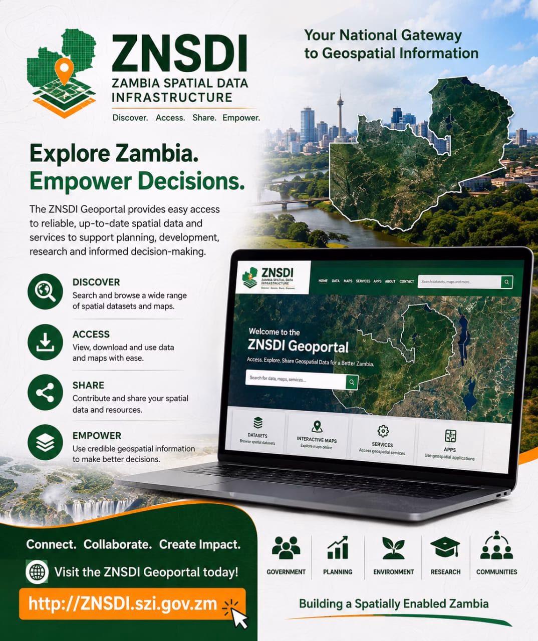
The ZNSDI portal is designed to centralise geospatial data and make it more accessible for planning and decision-making. It is expected to improve key national functions such as disaster response, urban development, agricultural planning, and environmental management by providing more accurate and timely location-based information.
The platform operates as a federated system, in which data ownership remains with the original custodians. Public institutions and stakeholders retain responsibility for maintaining their own datasets, while the ZNSDI provides a centralised system for referencing and accessing information across government. Its technical architecture includes a map server, a national map viewer, and a spatial data catalogue implemented using the open-source GeoNetwork platform, which publishes metadata records describing available datasets, their custodians, access conditions, and service links.
Addressing Capacity and Governance Gaps
The policy also seeks to tackle long-standing human resource and governance challenges. The availability of skilled personnel in the geospatial field has not kept pace with the growing demand, and most institutions rely on officers with general ICT qualifications and limited exposure to international geospatial standards. Retention of skilled staff has also been a persistent difficulty, as officers with GIS, software development, and data analytics skills have often moved to the private sector or international organisations in search of better remuneration and career progression.
To address these gaps, the policy establishes a clear institutional framework, designating the Electronic Government Division as the National NSDI Lead Authority, responsible for overall policy oversight, compliance monitoring, and inter-agency coordination. A network of steering and technical committees, alongside specialised technical working groups covering geospatial data, standards, and IT and clearinghouse functions, will support implementation across government.
Part of a Broader Digital Transformation Push
Overall, the launch reflects a broader push toward digital transformation and data-driven governance in Zambia. It also signals an effort to encourage innovation, improve transparency, and expand the use of geospatial technologies across both government and the wider development ecosystem, with the policy explicitly aligned to regional and global frameworks such as the African Spatial Data Infrastructure and the United Nations Integrated Geospatial Information Framework.
With non-sensitive datasets open by default under the new framework, and designated custodians required to publish metadata and adhere to regular update cycles, the policy aims to ensure that geospatial information collected using public resources is shared more widely across government and, where appropriate, with the public.