
DUNIA Launches Continental-Scale Sentinel-2 Archive and Browser-Based Index Calculations Across Africa

GeoVille, the lead implementing organisation of the European Space Agency’s flagship DUNIA programme, has unveiled a major enhancement to the platform aimed at transforming access to and utilisation of Earth Observation (EO) data across Africa.
The latest upgrade introduces continent-wide Sentinel-2 streaming and browser-based index calculation tools, reflecting Dunia’s vision of promoting an EO ecosystem that is open, decentralised, and built for accessibility, even at the most remote edges of the digital landscape.
Seamless EO Streaming Powered by EarthStreamer
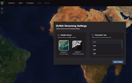
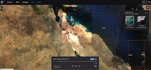
Through GeoVille’s EarthStreamer technology, users across Africa can stream high-resolution Sentinel-2 imagery easily and efficiently. Highly compressed EO datasets can be downloaded even over low-bandwidth networks, significantly reducing barriers to data access in under-connected regions.
For example, downloading a full month of Sentinel-2 data for three 10 m-resolution bands will take less than 30 minutes on a 10 Mbit/s connection, against the over two hours using conventional methods. The feature is fully accessible on desktop and mobile devices, ensuring low-bandwidth dissemination to users in rural or urban areas.
In-Browser EO Analytics: No Cloud Required
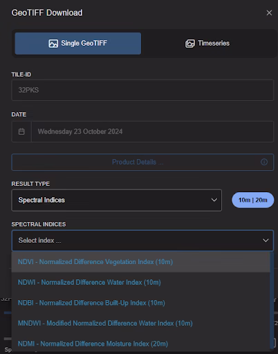
Complementing the streaming upgrade is the launch of a WebAssembly (WASM) module suite that brings EO analytics directly to users’ browsers; no cloud infrastructure is needed. Users can now calculate key surface indices instantly on their devices, supporting hyper-local decision-making without reliance on internet speed or server latency.
Supported indices include:
- NDVI (Normalised Difference Vegetation Index) – Monitors vegetation health and biomass.
- NDWI (Normalised Difference Water Index) – Highlights water bodies and surface moisture.
- NDBI (Normalised Difference Built-Up Index) – Detects urban areas and infrastructure.
- MNDWI (Modified NDWI) – Enhances visibility of water features in urban areas.
- NDMI (Normalised Difference Moisture Index) – Assesses vegetation or soil moisture levels.
An upcoming update to the platform’s Python Toolbox will enable full time-series or tile-based analysis using these indices, via configurable switches.
Supporting Democratised Data and Empowered Edge Computing
This rollout reinforces two key tenets of Dunia’s development areas:
- Democratised Data: Free and open EO data distributed through a decentralised network.
- Empowered Edge: Analysis performed locally on personal devices—cutting infrastructure costs, removing processing delays, and putting data power directly into users’ hands.
Growing African User Base and Community Engagement
Nineteen months post-launch, Dunia has amassed 1400 users across Africa, particularly in English- and French-speaking regions. Its community-centric design, collaborative features, and multilingual accessibility have made it a go-to platform for African developers, researchers, and decision-makers.
In addition, Dunia’s dedicated marketplace enables users to share scripts, products, and outputs, fostering collaboration regardless of technical expertise. The Dunia Sandbox further empowers users by offering a web-based workspace with curated EO datasets and tools, which are ideal for research, prototyping, and customised service deployment.
Dunia’s versatile architecture allows users to tailor EO-based solutions to their most pressing local challenges, from agricultural monitoring and urban planning to marine operations and environmental management. This latest update and ongoing user-centric improvements position Dunia as a next-generation EO platform, scalable, decentralised, and built for real-world use in the field, lab, or office.